Creating precise 3D building models with drone surveying and AI
The Airteam Fusion platform processes drone footage into precise 3D building models, measurements, and planning data – automatically, transparently, and ready for immediate use.


Everything for surveying, planning, and inspection. On one platform.

Surveying
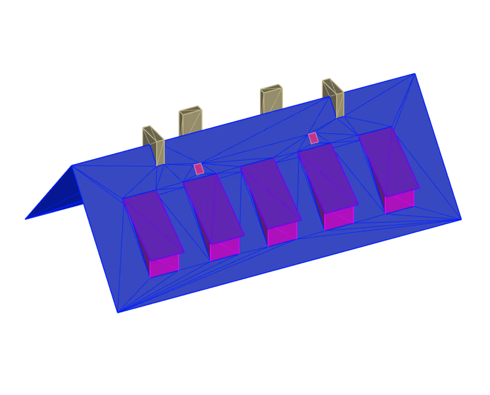
Create precise 3D building models from drone footage and measure roofs and facades directly in your browser. All measurements and survey reports are available digitally and form the basis for further planning.

Planning Data
Use your survey data directly in the software of your choice. Export CAD, BIM, and PV planning data to over 21 programs and continue working without manual data transfer.

Inspection
Document buildings digitally and identify damage faster. High-resolution individual images, thermography, and AI-supported analyses assist you with inspections and condition assessments.

Solar Planning
Cover roof areas with solar modules, align them optimally, and use precise building data as the foundation for your planning. If needed, you can then export the project to your preferred PV planning software.

AI Designer
Visualize changes to the building with just a few clicks. Test different materials, colors, or finishes directly on the 3D model and present various design options to your clients.

AI Inspection
Have image data analyzed automatically and identify anomalies faster. AI assists in the analysis of roofs and facades, making it easier to document damage and defects.
Why drones are the standard in surveying
Up to 90% less time spent on measurements
Transparent and verifiable data basis

Optimal cost-efficiency per project
Survey with drones flexibly according to your needs
.avif)
Subscriptions
For companies that regularly survey roofs or facades and want to manage their projects digitally and efficiently.
.avif)
Starter sets
For companies with no prior drone experience. A complete set including drone, training, and platform access.
.avif)
Single projects
For companies that only survey individual projects or would like to hand off the drone flight to Airteam.
It’s that simple
Create a new project with one click – no complicated setup or long forms. Ready to use immediately for your building surveys.
Capture all building measurements with a single drone flight – whether by your own team or an Airteam pilot. No more climbing, no more guessing, no more errors.
Upload your drone images with just a few clicks and no technical expertise required. The platform handles the rest.
Turn your drone images into a standards-compliant 3D model with all relevant measurements in no time – while you focus on other tasks.
Access all important measurements directly and export them for your site surveys, PV planning, or quotes. No post-processing needed, no more hidden errors.
How does the Airteam AI work?



Airteam success stories





New tools. Higher precision. Less effort.
Frequently asked questions about drone surveying
Ja. Die digitalen Daten und 3D-Modelle stehen auch nach Abschluss des Projekts zur Verfügung. Maße können nachträglich überprüft, Planungen angepasst oder Nachweise erstellt werden, ohne erneut vor Ort messen zu müssen.
Drohnenvermessung erhöht die Arbeitssicherheit, da Arbeiten in großer Höhe vermieden werden. Dächer und Fassaden müssen nicht betreten werden, was das Unfallrisiko deutlich reduziert
Nein. Du kannst Projekte selbst fliegen oder den Drohnenflug an Airteam übergeben. Auf Wunsch übernimmt ein zertifizierter Airteam-Pilot die Durchführung, inklusive Planung und Umsetzung des Flugs.
Ja. Auch kleinere Betriebe profitieren von Zeitersparnis, besserer Planung und höherer Sicherheit. Digitale Vermessung reduziert den Aufwand vor Ort und ermöglicht eine saubere Vorbereitung von Angebot, Planung und Dokumentation.
Drohnenvermessung eignet sich für Dächer, Fassaden, Photovoltaik-Anlagen, Industriehallen und Baustellen. Besonders bei großen Flächen, komplexen Geometrien oder schwer zugänglichen Bereichen bietet sie klare Vorteile gegenüber klassischen Messmethoden.
Bei der Drohnenvermessung wird das gesamte Gebäude aus vielen Perspektiven erfasst. Aus den Bilddaten entstehen präzise 3D-Modelle, auf deren Basis Flächen, Längen, Höhen und Volumen exakt berechnet werden können. Messfehler durch schwer zugängliche Stellen oder Schätzungen werden deutlich reduziert.