3D measurement: LiDAR VS photogrammetry


LiDAR and photogrammetry technologies use various techniques to measure objects and landscapes. Find out more now!
LiDAR VS photogrammetry
Due to current developments, misunderstandings and myths are circulating in the area of surveys and inspections with drones. It's about LiDAR and photogrammetry technologies; both measurement techniques are as different as they are similar. The products are suitable for completely different areas of application.
These factors influence the selection
Compared to traditional methods of land monitoring, both techniques undoubtedly deliver faster results with higher data density. Both technologies measure all visible objects without interpolation. The decision for a system depends on the following factors, among others:
- intended use
- environmental conditions
- Submission deadlines
- budget
The following information describes the strengths and limitations of LiDAR and photogrammetry and helps buyers make a choice.
How do the technologies work?
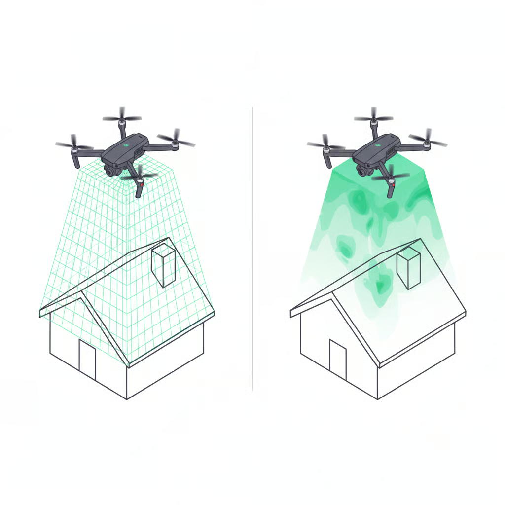
LiDAR stands for “Light Detection and Ranging” and is based on laser beams. The system shoots off lasers and measures the time until the light returns. It is a so-called active sensor, as the energy source is emitted.
On the other hand, photogrammetry is a passive technology based on the transformation of cartographic models in 2D to 3D. The same principles as the human eye or in 3D videos are used for depth perception. Users can view and measure objects in three dimensions. The limitation: Only points can be generated that are visible and can therefore be detected by the camera sensor.
In summary: LiDAR measures with lasers. Photogrammetry is based on photos that can be further processed and combined for measurements.
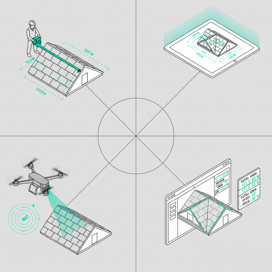
What information do photogrammetry reports provide?
These reports provide you with color models in 3D and 2D, which simplifies visual preparation and evaluation. RAW images, orthophotos, 3D point clouds and digital surface models fill the reports with important information. In doing so, the system processes hundreds or thousands of recordings. The pixel size (ground samping distance) is less than 1 cm. However, narrow objects such as power lines are less easy to model with this technology; geometric details are less pronounced.
This makes photogrammetry particularly suitable for applications in the area
- building surveying
- building inspection
- farming
What information do LiDAR reports provide?
The 3D point cloud provides the most important information in the LiDAR report. The density of the cloud depends on the properties of the sensor (scan frequency and repetition rate) and the flight parameters. Assuming that the scanner works at a fixed rate, the density of the point cloud depends on the flight altitude and speed of the drone.
Different application scenarios require different cloud parameters; for example, a cloud density of more than 100 points per square meter is required to model power cables. On the other hand, a density of ten points per square meter may be sufficient to create a digital model of an uninhabited area.
Also important: The LiDAR sensor detects positions without RGB colors; the data set in black and white can be difficult to evaluate. In addition, reflections can cause technical problems. It is possible to adjust the colors in post-processing by classifying points or using photos.
Since the laser beams penetrate the vegetation, you can use the technology to capture the terrain below. Suitable applications for LiDAR include:
- Digital landscape models (Digital Terrain Models)
- Modelling narrow objects such as power lines and mobile masts
- Use in low light conditions and at night
The precision
When evaluating accuracy, there are always two dimensions to consider: relative and absolute. Relative precision measurements are about the relative position of objects to each other. Absolute accuracy refers to the differences between the location of objects and their true position on Earth. That is also the reason why a report can have a high relative but low absolute accuracy.
The precision of photogrammetry measurements
With this technology, an accuracy of one to three centimeters can be achieved, but this requires extensive experience. For high absolute accuracy, the use of RTK/PPK technology and GCPs is necessary. However, an absolute accuracy of five to ten centimeters can already be achieved with a DJI Phantom class drone and a few GCPs, which is sufficient for many applications.
The accuracy of LiDAR
LiDAR is one of the most accurate measurement technologies on the market. This applies in particular to laser measurements on the earth's surface, where the sensor is positioned on the ground. Such a design enables precision of less than one centimeter. However, it is more difficult to achieve accuracy with aerial photographs because the sensor is always in motion. For this reason, when used with drones, LiDAR is always paired with an IMU (inertial motion unit) and a GNSS receiver, which provide information on position, rotation and movement. This data is combined in real time and enables a relative accuracy of 1 to 3 cm. For a high level of absolute accuracy, you also need one or two ground control points (GCPs) and a few checkpoints for verification.
Data collection, processing and efficiency
The two technologies differ significantly in terms of data collection speed. Photogrammetry requires images to overlap of 60 to 90 percent; LiDAR usually requires an airline overlap of 20 to 30 percent. For this reason, data collection with LiDAR is much faster. In addition, photogrammetry requires more GCPs for high absolute accuracy, which means additional time and costs.
In addition, data processing with LiDAR is very fast. The raw data only requires a few minutes of calibration to generate the final product. Photogrammetry takes the most time to process the images; in addition, a powerful computer with many gigabytes of free storage space is required. Data processing can take ten times longer than collection.
On the other hand, the LiDAR point cloud requires an additional classification to inspect power cables or the like. This is also time-consuming and users often need expensive software such as TerraScan.
The costs of LiDAR and photogrammetry
There are several things to consider when looking at costs. First, the hardware: The UAV LiDAR sensor set consisting of scanner, IMU and GNSS costs between 50,000 and 300,000 US dollars. To ensure that the aircraft does not crash and the expensive sensor is damaged, most invest an additional between 25,000 and 50,000 US dollars for a suitable drone. This results in total costs of up to 350,000 US dollars.
Only a drone with a camera is required for photogrammetry. For 2,000 to 5,000 US dollars, there are professional drones such as the DJI Inspire. For a price of 5,000 to 20,000 US dollars, there are sets with RTK/PPK, such as the DJI Matrice 600, or models with fixed wings, such as the Sensfly eBee and PrecisionHawk Lancaster.
Another cost factor is software for data processing. With LiDAR, this is usually included in the package. Third-party software such as TerraScan can be used for point classification; a single license costs 20,000 to 30,000 US dollars. The photogrammetry software has a monthly cost of around 500 US dollars.
Other important factors include, of course, the required manpower and time. LiDAR is clearly ahead of the pack here, as data processing is significantly faster. As a result, services offered with photogrammetry are usually much cheaper, as the costs of expensive hardware are eliminated. Depending on the area of application, however, the additional costs can be worthwhile through the following savings.
Conclusion
Both technologies have their use cases and limitations. No technology is better than the other, no one can cover all areas of application. Photogrammetry is the ideal option for projects that require visualized data, such as roof surveys, agriculture, and building inspections. LiDAR is certainly the right choice for measuring narrow objects. When used correctly, both techniques are highly beneficial. Availability should increase as hardware and software prices fall in the future. Further groundbreaking developments are expected in the coming years. We'll keep you up to date!