The ultimate guide to PV system planning using PV*SOL premium and Airteam drone data


PV*SOL premium is the program for PV system planning; Airteam provides the necessary data for planning & shading analysis. Find out more now!
PV system planning with drone data in PV*SOL premium
The planning and simulation software PV*SOL premium is the industry standard for PV planning programs. The program for PV system planning impresses with helpful 3D visualization and detailed shading analysis, among other things. With PV*SOL premium, professionals plan their photovoltaic systems depending on electrical consumers, electric vehicles and battery systems.
With the help of Software and exact data You can virtually design and simulate all types of modern PV systems. PV*SOL premium is equally worthwhile for small roof systems, commercial roofs and large solar parks.
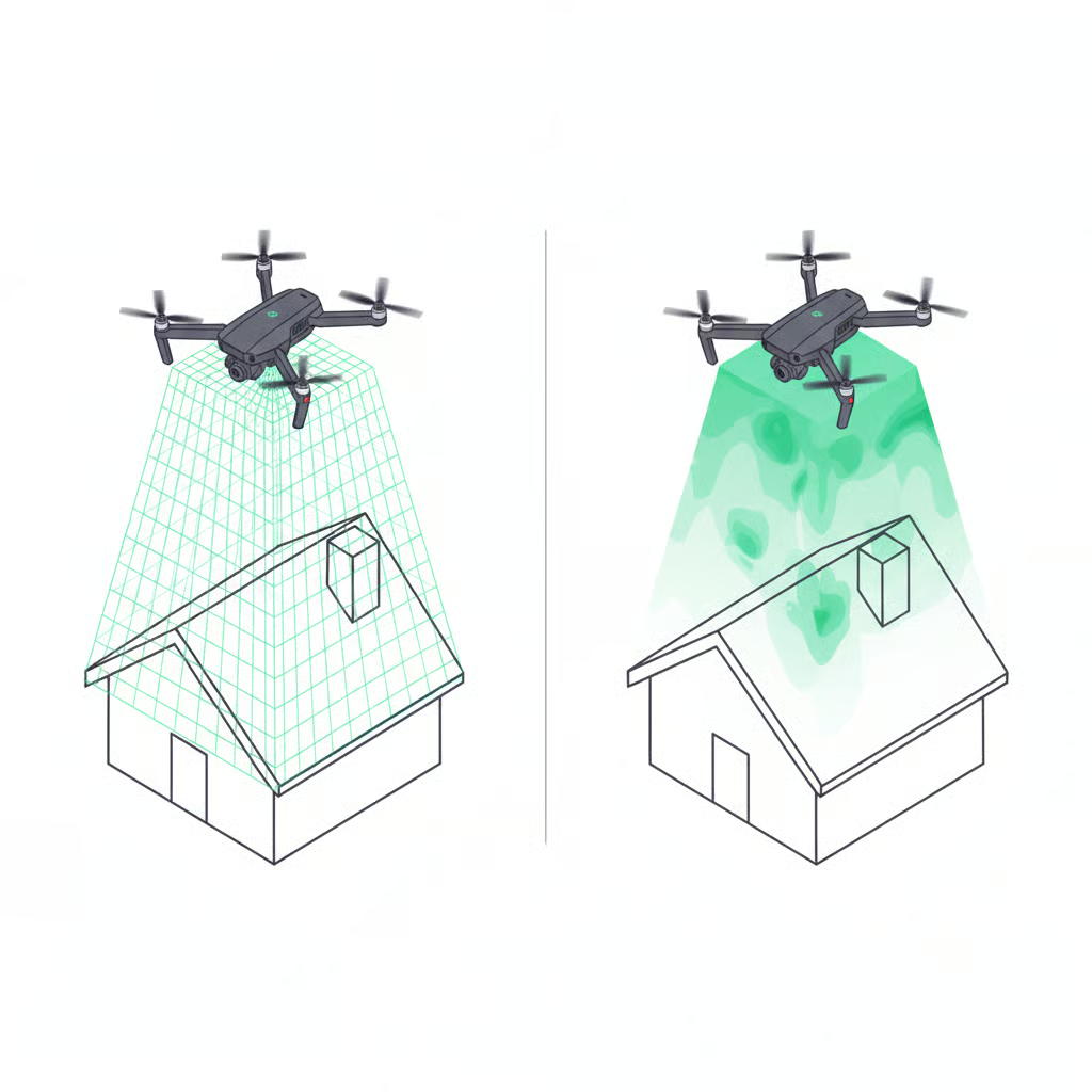
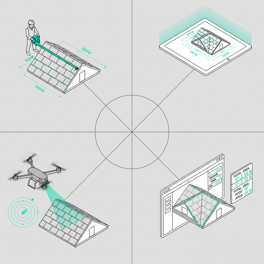
Airteam misses buildings and areas with drones. The precise drone data replaces manual roof measurements and delivers exact 3D measurement data for survey reports — while measurements via satellite are inaccurate and, for example, inadequate when the roof is inclined.
The benefits:
- high-precision measurements for location analysis
- up to 90 percent faster than traditional surveying methods
- No unnecessary trips thanks to access to a nationwide pilot network
- CAD 3D data (.obj, .dxf, .dwg and .skp formats) can be read directly into PV*SOL premium
Find out now how to import drone data from Airteam into PV*SOL premium, professionally plan and simulate your PV system. The combination guarantees that you can reliably forecast the yield of the PV system. For this purpose, the shading analysis uses climate data and provides realistic results.
PV system planning guide: Integrate data from Airteam into PV*SOL premium
Airteam generates the necessary data for every solar project; you can find it on the Airteam Fusion Platform. At the bottom of the page is the category “Low-Poly-PVSol”, which usually contains three files that are available for download:
- The .obj file contains the 3D structure of the measured object.
- The .png file contains the color texture of the text model.
- The .mtl file mediates between the other two files and ensures correct placement.
Note: The exclusive use of .obj files is possible, but then the color texture is missing.
The drone data can be further processed in ten quick steps:
1. Save the three files locally and open PV*SOL premium.

Figure 1: Planning the PV system starts with a click on the house icon and on the text with “no system diagram available”.
2. In the navigation bar, click on “3D planning” (icon with house).

Figure 2: The occupancy object is selected using a map section.
3. In the next window, click on “no system diagram available” and select “Map section” from the drop-down menu.
4. Select the displayed map and enter the address of the object in the search field. (Tip: The address can be found on the Airteam platform in the respective project.)

Figure 3: The object is centered.
5. Now position the camera so that the object is in the center of the image and is completely imaged and click on “Start”. You can see the object as shown in Figure 4.

Figure 4: Now the .obj file is loaded and the 3D model is placed.
6. Now it is the time to import the 3D model. To do this, click on “Import” in the menu bar under 3D models and select the locally saved .obj file. Click on “Drag 3D object” and adjust parameters such as sky orientation until the model is optimally above the map. To do this, click on the object and select “Edit” (Figure 5).
7. You select the roof surfaces by double-clicking on the model and can have the surfaces determined automatically.

Figure 5: The roof surfaces can now be selected individually.
8. If you now move the mouse cursor over the model, you will see the individual roof surfaces (Figure 5).
9. The desired roof area is selected with a right click and when you click on “Activate”, PV*SOL premium automatically zooms to the desired roof area.
10. Planning the PV system can begin.
Tips for use and PV system planning

Figure 6: You must select the PV modules for occupancy.
The following tips will help you to optimally occupy the available space. For model assignment, first click on the “Module assignment” tab and select the reference modules.
Lock selected roof areas

Figure 7: Block unsuitable areas.
With restricted areas, you identify the areas on the roof that cannot or should not be covered with PV modules. To draw these areas, select the “Draw polygon lock area” tool in the “Object View” tab and mark the corresponding areas.
Place individual models on the roof
First, search for the appropriate photovoltaic module (manufacturer, model series, etc.) from the database and conveniently place individual modules by dragging and dropping. If the display is green, it is possible to store it at the selected location, but not if marked in red.
Automatically cover the entire roof area with PV modules
Figure 8: Allow the entire roof area to be covered.
What is the maximum number of modules that fit on the roof or the available area? PV*SOL premium will answer this question automatically. To do this, simply click on “Documents” in the navigation. The configured mounting angles and module distances are taken into account. If necessary, you can delete, completely delete or change the placed modules individually.
Automatically fill areas with modules
If you are planning the occupancy of partial areas, you can select “Open” in the navigation and mark the area in the form of a rectangle. The vertical and horizontal distances between the modules are also adjustable.
Analyze the shading

Figure 9: Shadow analysis is one of the special features of PV*sol premium.
One of the many other practical functions of the software is the analysis of shading. The program calculates these based on GPS coordinates and roof orientation. In this way, you can see the optimal module layout at a glance.
Tip: In PV*SOL premium handbook You will find detailed explanations of all functions.
Conclusion
The combination of PV*sol premium and drone data from Airteam is rapidly accelerating the planning phase of PV systems. You will check the options in a very short time, try out different systems, analyze the shading and thus find the perfect solution for every roof.